Our Vision
To drive the evolving concept of spatial data infrastructures and modernization of land administration systems by developing advanced 3D virtual information systems, that integrate, model, and visualize data and make it accessible for solving the demands faced by modern society.
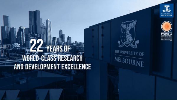
22nd Anniversary of the CSDILA
We celebrated a significant milestone as we marked the 22nd Anniversary of CSDILA during our event, the "International Forum on Digital Infrastructure for Climate Resilience", on Friday, 20 Oct. We sincerely appreciate the invaluable contributions of each individual over the past 22 years for their incredible support and collaborative efforts, which have been instrumental in shaping the success of our Centre.
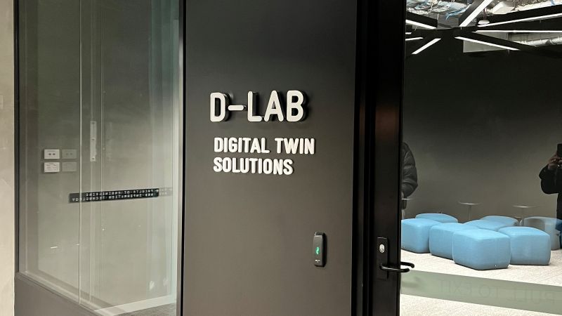
D-lab The Museum of Future
CSDILA has developed Digital Lab (D-lab), a nationally unique space enabling industry collaboration and the development of new research areas. There has been significant investment in the D-Lab which brings together the latest visualisation technologies.
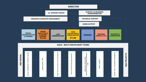
CSDILA Structure and Capabilities
In order to support CSDILA operation in line with our 5-year strategic plan, and with CSDILA achievements and core capabilities to date, we have advanced our Organisational Structure by introducing a number of Research Units to empower the Centre to be agile with more flexibility in our operation and resource allocation and management. With this new structure, we have appointed an academic lead for each unit.
-
About the Centre
The Centre undertakes research in a variety of areas relating to spatial data infrastructures, spatial enablement and land administration in order to support the sustainable development goals.
-
Projects
Find out about our strategic and major research projects
-
News and Events
View our latest news and updates; hear about upcoming workshops, seminars and conferences; subscribe to our newsletter; or follow us on LinkedIn.
-
People
Find out about our researchers, leadership, graduate researchers and advisory committee.
-
Publications
View our journal articles, download free open-source texts, read theses from our alumni and catch up on past newsletters.
-
Research
View details of our current and complete research projects.
-
Study with us
We offer a research program, and a graduate training program.
-
Contact us
Contact details for our director and administration staff.