Books and reports

The Science behind the COVID Pandemic and Healthcare Technology Solutions
2022
Editors: Sasan Adibi, Abbas Rajabifard, Sheikh Mohammed Shariful Islam, Alireza Ahmadvand
This book offers a timely review of modern technologies for health, with a special emphasis on wireless and wearable technologies, GIS tools and machine learning methods for managing the impacts of pandemics. It describes new strategies for forecasting evolution of pandemics, optimizing contract tracing, and for detection and diagnosis of diseases, among others. Written by researchers and professionals with different backgrounds, this book offers a extensive information and a source of inspiration for physiologists, engineers, IT scientists and policy makers in the health and technology sector.
COVID-19 Pandemic, Geospatial Information, and Community Resilience
2021
Rajabifard, A. (Ed.)
COVID-19 Pandemic, Geospatial Information, and Community Resilience [pdf]
Sustainable Development Goals Connectivity Dilemma: Land and Geospatial Information for Urban and Rural Resilience
2019
Rajabifard, A. (Ed.)
Sustainable Development Goals Connectivity Dilemma [pdf]
BIM and Urban Land Administration
2019
Rajabifard, A.; Atazadeh, B.; Kalantari, M. (2019). Taylor & Francis, CRC Press.

Spatial Enablement in a Smart World
2016
Edited by: David Coleman, Abbas Rajabifard, Joep Crompvoets
Spatial Enablement in a Smart World [7.2mb pdf]
Spatial enablement is a concept implicit in the importance of location for developing the ‘smart cities’ and ‘smart communities’ concepts. Considering this, as well as the different systems, policies, institutional arrangements, technologies, environments, procedures, and strategies already in place, gives us the opportunity to examine how far we have progressed in spatially enabling ‘smart city’ and ‘smart country’ initiatives worldwide, in addition to what still needs to be done.
This book is divided into two parts, each part focussing on different aspects of applying spatial data or spatial technologies to deliver Spatial Enablement in a Smart World. The chapters are written by authors from twelve different countries across five continents and describe a combination of new developments and lessons learned in this journey towards achieving a spatially enabled smart world.
Spatial Enablement in Support of Economic Development and Poverty Reduction: Research, Development and Education Perspectives
2013
Edited by: Harlan Onsrud and Abbas Rajabifard
Spatial Enablement in Support of Economic Development and Poverty Reduction [7.25mb pdf]
The articles featured in this peer-reviewed book were mostly the result of the traditional Call for Papers for the GSDI 14 Global Geospatial Conference “Spatial Enablement in Support of Economic Development and Poverty Reduction”, but also contains contributions of full articles which were solicited for publication in this book.
This book is the result of a collaborative initiative between the Global Spatial Data Infrastructure Association (GSDI), the School of Computing and Information Science at the University of Maine, and the Centre for SDIs and Land Administration (CSDILA) in the Department of Infrastructure Engineering at the University of Melbourne.
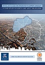
Spatial Data Access and Integration to Support Livability: A Case Study in North West Melbourne
2013
Edited by: Abbas Rajabifard and Serryn Eagleson
Spatial Data Access and Integration to Support Livability [2.91mb pdf]
This publication ‘Spatial Data Access and Integration to Support Liveability: a Case Study in North and West Melbourne’ is the result of a collaborative initiative of the University of Melbourne, School of Engineering, Department of Infrastructure Engineering, Centre for Spatial Data Infrastructures and Land Administration (CSDILA), the Australian Urban Research Infrastructure Network (AURIN), the Australian National Data Service (ANDS), the North West Melbourne Regional Management Forum, the Victorian Government and the McCaughey VicHealth Centre for Community Wellbeing for initiating the groundwork for the project.
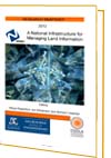
A National Infrastructure for Managing Land Information: Research Snapshot
2012
Edited by: Abbas Rajabifard, Ian P. Williamson and Mohsen Kalantari
A National Infrastructure for Managing Land Information: Research Snapshot [2.91mb pdf]
This publication highlights the importance of a national land administration infrastructure to support sustainable development. It contains a summary of research connected to the national infrastructure for managing land information project funded by the Australian Research Council Grant (LP0990571:2009–2012). This summary also covers other related research conducted over these last four years. The projects identifies the drivers and components required for better management of land and property at a national level for Australia and makes recommendations for similar federated countries. The research project has been coordinated through the Centre for Spatial Data Infrastructures and Land Administration, the University of Melbourne in close collaboration with industry partners.
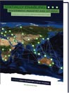
Spatially Enabling Government, Industry and Citizens: Research and Development Perspectives
2012
Edited by: Abbas Rajabifard and David Coleman
Spatially Enabling Government, Industry and Citizens [4.51mb pdf]
This book is the result of a collaborative initiative of the Global Spatial Data Infrastructure Association (GSDI), the Centre for SDIs and Land Administration (CSDILA) in the Department of Infrastructure Engineering at the University of Melbourne, and the Geographical Engineering Group in the Department of Geodesy and Geomatics Engineering at the University of New Brunswick. In addition to the traditional Call for Papers for the GSDI 13 Global Geospatial Conference: ‘Spatially Enabling Government, Industry and Citizens’, contributions of full articles were solicited for publication in this peer reviewed book.
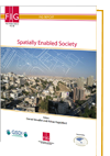
Spatially Enabled Society
FIG Publication No. 58
2012
Edited by: Daniel Steudler and Abbas Rajabifard
FIG Publication No. 58 report [2.63mb pdf]
The needs of societies are increasingly of global scale and require spatial data and information about their land, water and other resources — on and underground — in order to monitor, plan, and manage them in sustainable ways. Spatial data and information, land administration, land management, and land governance play crucial roles in this.
Spatial enablement is a concept that adds location to existing information, thereby unlocking the wealth of existing knowledge about land and water, its legal and economical situation, its resources, access, and potential use and hazards. Societies and their governments need to become spatially enabled in order to have the right tools and information at hand to take the right decisions. Spatially Enabled Society — including its government — is one that makes use and benefits from a wide array of spatial data, information, and services as a means to organise its land and water related activities.
This publication focuses essentially on six fundamental elements, which are required to realise the vision of a Spatially Enabled Society:
- a legal framework to provide the institutional structure for data sharing, discovery, and access
- a sound data integration concept to ensure multi-sourced data integration and interoperability
- a positioning infrastructure to enable and benefit from precise positioning possibilities
- a spatial data infrastructure to facilitate data sharing, to reduce duplication and to link data producers, providers and value adders to data users based on a common goal of data sharing
- land ownership information, as the dominant issue in the interactions between government, businesses and citizens relating to land and water resources
- data and information to respect certain basic principles and to increase the availability and interoperability of free to re-use spatial data from different actors and sectors.
Realising Spatially Enabling Society: Research, Emerging Trends and Critical Assessments
2010
Edited by: Abbas Rajabifard, Joep Crompvoets, Mohsen Kalantari, Bas Kok
Realising Spatially Enabling Society [10.16mb pdf]
A society can be regarded as spatially enabled where spatial information and location are widely used to manage information and processes spatially to encourage more creativity and product development and they become ubiquitous part of eGovernment and broader government ICT strategies.
With this background, in this timely scholarly volume, Abbas Rajabifard, President of the Global Spatial Data Infrastructure Association (GSDI), Joep Crompvoets, Mohsen Kalantari and Bas Kok, past president of GSDI, present the latest research by renowned international experts and offers insights into possible directions in which spatial enablement and SDI as an enabling platform may be headed. The book is focusing on different aspect of spatially enabled societies (SES). All the chapters together give an overview of the current concepts, fundamentals, activities, facilities and practices of SES in the world with an aim to further contribute to the understanding of, and address the issues, challenges and requirements in achieving a spatially enabled society.
From both theoretically and practical focus, the book explains the concepts and fundamentals of SES in more depth from different perspectives and also reviews the status of SES in different parts of the world, in particular in Asia and the Pacific and Europe. The book then looked at the facilities that ease and assist in accomplishing the objectives of SES and then presented some practices leading to towards SES.
Land Administration for Sustainable Development
2009
By Ian Williamson, Stig Enemark, Jude Wallace, and Abbas Rajabifard
Land Administration for Sustainable Development [English] [87MB pdf]
Land Administration for Sustainable Development [Spanish] [42MB pdf]
This latest book on Land Administration for Sustainable Development examines global land administration systems at different levels of maturity. This examination elucidates how countries can establish basic infrastructure for the implementation of land-related policies and land management strategies that will help ensure social equality, economic growth, and environmental protection. Through its presentation of a holistic view of land management for sustainable development, this book outlines basic principles of land administration applicable to all countries and their divergent needs. Land Administration for Sustainable Development is a resource for professors and students of land planning, land administrators, land planning managers, and government officials.
A Multi-View Framework to Assess Spatial Data Infrastructures
2008
Edited by: Joep Crompvoets, Abbas Rajabifard, Bastiaan van Loenen, Tatiana Delgado Fernández
View A Multi-View Framework to Assess Spatial Data Infrastructures online
This book aims to promote a better understanding of SDI assessment by providing the concepts, demands and implication of SDI-assessments, a compilation of existing approaches to assess SDIs. The book also provides examples to assist practitioners to develop more comprehensive and appropriate evaluations to fit with assessment demands. The book is designed to be a professional resource to strength capacity of information resource management in the context of SDI assessment. Each contribution has come from leaders and researchers who have an interest in SDI design and assessment.
Editors are thankful to the members of SPATIALIST, CYTED IDEDES, Centre for Spatial Data Infrastructures and Land Administration in Department of Geomatics (The University of Melbourne, Australia), Centre for Geo-information (Wageningen University, The Netherlands), Ruimte voor Geo-Informatie (Space for Geo-Information) The Netherlands , Delft University of Technology (Delft, The Netherlands) and IWT-Flanders, the Institute for the Promotion of Innovation by Science and Technology in Flanders (Belgium) for encouragement and support.
Towards a Spatially Enabled Society
2007
Edited by Abbas Rajabifard
The Centre has recently published a book on Spatially Enabled Society. It is dedicated to Professor Ian Williamson and includes contributions from Australian and international experts:
Sustainability and Land Administration Systems
2005
Edited by Ian Williamson, Stig Enemark and Jude Wallace
Sustainability and Land Administration Systems [8.70mb pdf]
Developing Spatial Data Infrastructures: From Concept To Reality
2003
Edited by Ian Williamson, Abbas Rajabifard and Mary Ellen F. Feeney
Expert perspectives on SDI theory and practice
The spatial data infrastructure (SDI) concept continues to evolve and become an increasingly important element of the infrastructure that supports economic development, environmental management, and social stability. Because of its dynamic and complex nature, however, it remains a fuzzy concept to many, and depending on their needs and circumstances, practitioners, researchers, and governments adopt different views of it.
Developing Spatial Data Infrastructures: from Concept to Reality makes a timely contribution to the theory and practice of SDIs and breaks new ground in improving understanding of their relevance and value. It provides expert overviews of policies, concepts, standards, and practices associated with the design, implementation, and operation of SDIs. It introduces the concept of an SDI Hierarchy based on Hierarchical Spatial Reasoning, sets out the similarities and differences between SDIs operating within and between different jurisdictions, and identifies factors key to the success of SDI initiatives.
Built on key contributions to the International Symposium on Spatial Data Infrastructure held in Melbourne in November 2001, this book is the first of its kind to provide address both the theoretical and practical aspects of developing appropriate SDIs. It offers unique, detailed discussions on the challenges and direction of future SDI development and thus provides an outstanding resource for those involved in building and maintaining SDIs and for GIS professionals and students.